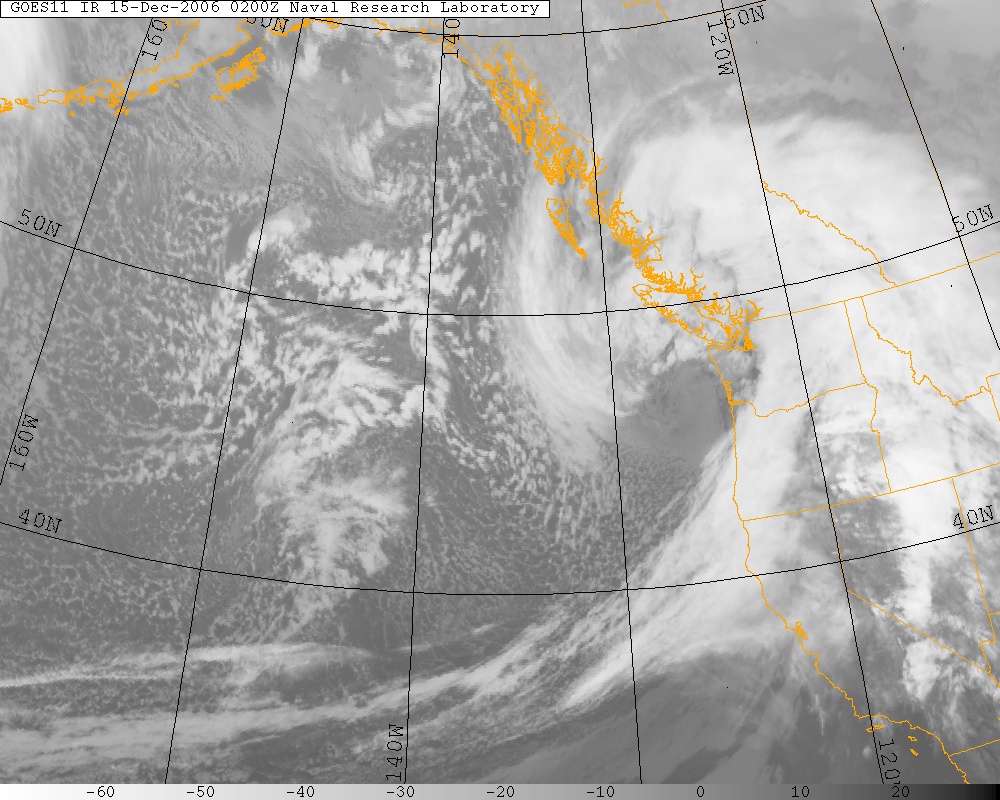
Infrared Satellite image of the Hanukkah Eve Storm on 12/14/06 @ 6 P.M. PST, courtesy of US Naval Research Laboratory
Extratropical storms get their energy from a boundary, or front, between two different air masses. According to the Norwegian Cyclone model, a model created by the Bergen School of Meteorology in the 1910s and 20s, there are four main stages that extratropical cyclones go through.

The updated Norwegian Cyclone Model. Credit: Schultz & Vaughn (2011)
Stage 1: Open Wave

Open wave stage of the 2/4/2006 cyclone. Image courtesy of Wolf Read.
The first stage is what is called an open wave. A storm starts off with a stationary front dividing warm air from the south and cold air from the north. Because of the Coriolis Effect, cold air will push south and warm air will push north, creating a center of rotation with fronts that spin counter-clockwise in the Northern Hemisphere, and clockwise in the Southern Hemisphere.
Stage 2: Fully Developed Cyclone

Fully developed cyclone stage of the 2/4/2006 cyclone. Image courtesy of Wolf Read.
The second stage is a fully developed cyclone. The counter-clockwise rotation that began with the open wave strengthens and the pressure begins to drop, and the storm takes on less of a horizontal appearance and begins to make the familiar comma shape that we often see with these types of storms. As warm air from the south is sucked into the center of the storm, it rises, expands, condenses, and cools, while releasing latent heat from the condensation of water droplets in the process. At this stage of the cyclone, there is more air being sucked up than air filling the low pressure center at the surface. Because of this process, additional air molecules are being expelled, creating lower atmospheric pressure throughout the mid and lower levels of the storm.
Stage 3: Occluded Cyclone

Occluded cyclone stage of the 2/4/2006 cyclone. Image courtesy of Wolf Read.
The third stage is the occluded cyclone. Since cold fronts move faster than warm fronts, the cold front catches up and overtakes the warm front. This creates a new type of front – an occluded front. Occluded fronts share the characteristics of both warm and cold fronts. This is most intense stage of the cyclone, but sometime into this stage, the cyclone begins to weaken. This is because the air masses on either side of the occluded front are similar in temperature and humidity, and since extratropical storms get their energy from different air masses along a front, they are cut off from their energy source and slowly weaken.
Stage 4: Dissipating Cyclone

Dissipating cyclone stage of the 2/4/2006 cyclone. Image courtesy of Wolf Read.
The fourth stage is the dissipating cyclone. The occlusion increases to the point where it chokes off the supply of warm air feeding the cyclone ahead of the warm front. When this happens, the low pressure system starts to weaken.
Other Notes
A storm can get especially strong when it is fed by a strong jet stream. As previously stated, cyclones deepen when warm, surface air rises into colder air, with more air rising from the center than rushing to it. A strong jet stream will speed up this process. Warm air will converge at the center at a faster rate, and the cooled air aloft will diverge faster, making way for new air to fill the void.
The result can be a huge storm with winds that can sometimes approach category 3 hurricane speeds. In addition, these storms are much, much larger and usually move much faster. The Columbus Day Storm of 1962, which ravaged California to Vancouver Island with hurricane force winds, is a prime example of how strong these storms can be.
Written by Charlie Phillips – charlie.weathertogether.net. Last updated 12/1/2017
Sources:
Schultz, D. M., & Vaughan, G. (2011). Occluded Fronts and the Occlusion Process: A Fresh Look at Conventional Wisdom. Bull. Amer. Meteor. Soc. Bulletin of the American Meteorological Society, 92(4), 443-466. doi:10.1175/2010bams3057.1