-

Cathie Ursu wrote a new post on the site Mid Michigan Weather 8 years ago
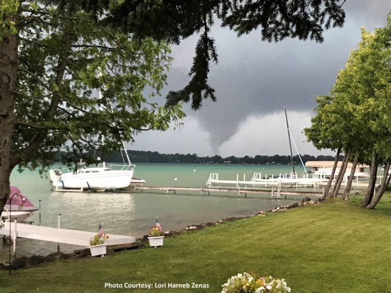
Thousands are still without power in northern lower Michigan after severe storms moved through the state on Tuesday night. At least 4 tornadoes have been confirmed and much straight line wind damage in the […]
-

Jeff Taylor wrote a new post on the site Happy Valley, Oregon Weather 8 years ago
FINAL UPDATE 9/10/2018:
With this morning’s 0.01″ rain measurement, falling between 5:00 and 6:00 A.M., the record-streak of consecutive days with no measurable precipitation has come to an […]

-

Kevin Shaw wrote a new post on the site West Rockville MD Weather 8 years ago
A partly cloudy Wednesday was once again downright hot and humid, our third one of several this week this last week of August, with high temps reaching the lower 90s and dew points once again climbing through the […]

-
William Brantley wrote a new post on the site Jackson, TN's Climate Summary 8 years ago
Lowest Barometric Pressure : 30.03″ at 8 p.m.
Highest Barometric Pressure : 30.13″ at 8, 9 a.m.Lowest Relative Humidity : 54% at 2 – 4 p.m.
Highest Relative Humidity : 94% at 11:59 p.m.Lowest Dew Point […]

-
Cathie Ursu wrote a new post on the site Mid Michigan Weather 8 years ago
Last night was very stormy in Michigan with many cleaning up the damage this morning. Fortunately, all we got was heavy rain and a lot of thunder. The central regions of the state seem to have the most d […]

-
Kevin Shaw wrote a new post on the site West Rockville MD Weather 8 years ago
Tuesday was downright hot and humid, our second one of several this week during this last week of August, with high temps reaching the lower 90s and dew points once again climbing through the 70s under muggy […]

-
William Brantley wrote a new post on the site Jackson, TN's Climate Summary 8 years ago
Lowest Barometric Pressure : 30.02″ at 7 p.m.
Highest Barometric Pressure : 30.13″ at 9 a.m.Lowest Relative Humidity : 46% at 3 p.m.
Highest Relative Humidity : 96% at 1 a.m.Lowest Dew Point Tempe […]
-
Kevin Shaw wrote a new post on the site West Rockville MD Weather 8 years ago
Monday was very warm and humid, our first one of several this week this last week of August, with high temps in the upper 80s and dew points climbing through the 70s under muggy southerly breezes. The Monday […]

-

Charlie Phillips wrote a new post on the site Charlie's Weather 8 years ago
What a refreshing weekend! With a high of only 68 degrees, Sunday was Portland’s first sub-70 degree day since we hit 69 degrees on June 14. Our chill was brought to us via a deep upper-level trough arriving […]

-
William Brantley wrote a new post on the site Jackson, TN's Climate Summary 8 years ago
Here is Monday – August 27, 2018`s – Historical Climate Summary !
Lowest Barometric Pressure : 30.01″ at 7, 8 p.m.
Highest Barometric Pressure : 30.13″ at 10, 11 a.m.Lowest Relative Humidity : 49% at […]
-
Kevin Shaw wrote a new post on the site West Rockville MD Weather 8 years ago
Sunday was still relatively nice but warmer and more humid, with high temps around 85°, but with dew points climbing through the 60s into the low 70s, and more southerly breezes bringing these conditions into the […]

-
William Brantley wrote a new post on the site Jackson, TN's Climate Summary 8 years ago
Here is Sunday – August 26, 2018`s – Historical Climate Summary !
Lowest Barometric Pressure : 30.07″ at 7 p.m.
Highest Barometric Pressure : 30.19″ at 9 – 11 a.m.Lowest Relative Humidity : 49% at 2, 3 p […]
-
Cathie Ursu wrote a new post on the site Mid Michigan Weather 8 years ago
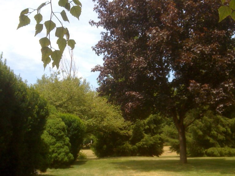
Being outdoors today is very uncomfortable. If not for the breeze, it would be unbearable, at least for me. We have had mostly cloudy skies so far but no rain. We did receive 0.19 in yesterday morning in th […]
-
Kevin Shaw wrote a new post on the site West Rockville MD Weather 8 years ago
Saturday was another nice day featuring sunny skies, high temps only around 80°, but with dew points starting to climb into the mid 60s, and pleasant breezes that were starting to turn over to a more southerly […]

-
William Brantley wrote a new post on the site Jackson, TN's Climate Summary 8 years ago
Here is Saturday – August 25, 2018`s – Historical Climate Summary !
Lowest Barometric Pressure : 30.04″ at 2 a.m.
Highest Barometric Pressure : 30.14″ at 10, 11 a.m.Lowest Relative Humidity : 46% at 4 p.m […]
-
Kevin Shaw wrote a new post on the site West Rockville MD Weather 8 years ago
Well Friday was another nice day featuring sunny skies, high temps only around 80°, dew points mostly in the 50s, and pleasant breezes. The Friday maximum temperature was 80.7° @ 1415, while the Thursday minimum t […]

-
Cathie Ursu wrote a new post on the site Mid Michigan Weather 8 years ago
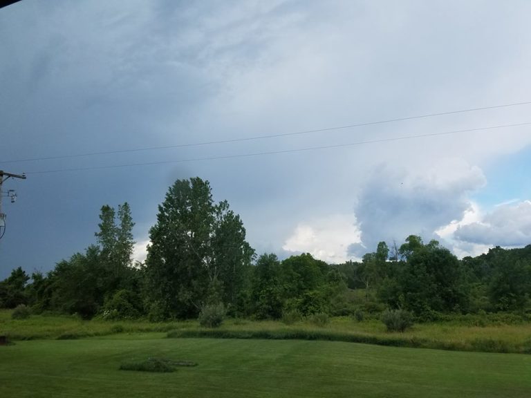
I woke to see a large rain cell on radar approaching my area and my first thought was to get the dogs out before it started raining. I’m glad that I did because it has been raining ever since; and it looks like […]
-
Kevin Shaw wrote a new post on the site West Rockville MD Weather 8 years ago
JULY 2018 MONTHLY SUMMARY ROCKVILLE 2.8 WNW MARYLAND
By Kevin Shaw, Observer in ChargeJuly 2018 was a tale of two distinct, different patterns. The first 16 days of the
month was hot and dry (all 8 days […]

-
Kevin Shaw wrote a new post on the site West Rockville MD Weather 8 years ago
The cooler, drier air finally moved in totally on Thursday, with clear, blue skies and dew points mostly in the 50s all day giving our region a chance to continue the drying out process and a chance to cool off. […]

-
William Brantley wrote a new post on the site Jackson, TN's Climate Summary 8 years ago
Lowest Barometric Pressure : 30.05″ at 11:59 p.m.
Highest Barometric Pressure : 30.19″ at 10 a.m.Lowest Relative Humidity : 43% at 2 – 4 p.m.
Highest Relative Humidity : 100% at 2, 5 – 7 a.m.Lowest Dew […]
- Load More



Thanks for the great report Cathie. I dug up some more information on the 4 confirmed tornadoes from the Gaylord MI NWS website. I didn’t see an F2 tornado in this report – 2 F0 and 2 F1 tornadoes and they didn’t use Lapeer that I could see. But they mentioned the same counties you did. Perhaps the F2 tornado you reported from Lapeer was evaluated for strength under further review after this NWS report, found at the following NWS website:
https://www.weather.gov/apx/severe-2018Aug28
Hi again Cathie. I double checked the location of Lapeer and found it considerably south of the Gaylord MI forecast office area of responsibility (AOR). It showed up in Google Maps east of Flint and within the Detroit/Pontiac NWS forecast office AOR. So I went to their page and unfortunately they apparently did not go out to Lapeer that I could see and check out this tornado and issue a report like the Gaylord office did. The NWS office out of Detroit/Pontiac does have a limited storm report for August 28, and it is at this website:
https://www.weather.gov/dtx/svrwx180828
I found out that the F2 tornado was just north east of West Branch. It wasn’t Lapeer.
Thanks Cathie. Makes more sense. I found West Branch on my Large Print Road Atlas. Looks like it is about 20-30 miles SE of Gaylord off of I-75. I just love travel and following routes with good maps. I was always the navigator on family trips while growing up.