-
William Brantley wrote a new post on the site Jackson, TN's Climate Summary 7 years, 10 months ago
Lowest Barometric Pressure : 29.99″ at 7, 8 p.m.
Highest Barometric Pressure : 30.09″ at 9 a.m.Lowest Relative Humidity : 50% at 3 p.m.
Highest Relative Humidity : 100% at 1, 2, 4 – 6 a.m.Lowest Dew Poin […]

-

Kevin Shaw wrote a new post on the site West Rockville MD Weather 7 years, 10 months ago
Tuesday was a hotter day as highs reached into the low 90s, with dew point temperatures creeping up more through the 60s into the low 70s. I actually observed a few cumulus this afternoon for the first time since […]

-
William Brantley wrote a new post on the site Jackson, TN's Climate Summary 7 years, 10 months ago
Lowest Barometric Pressure : 30.03″ at 7, 8 p.m.
Highest Barometric Pressure : 30.18″ at 12, 9 a.m.Lowest Relative Humidity : 56% at 2, 3 p.m.
Highest Relative Humidity : 100% at 12 – 6 a.m.Lowest Dew […]
-

Harry Hayfield wrote a new post on the site The Weather of Wales (and other parts of the United Kingdom) 7 years, 10 months ago
Maximum Temperature: 71°F
Minimum Temperature: 65°F
Temperature at 0800 BST (July 11th): 66°F
Rainfall: 0.009 inches (0.25 mm)
Wind Speed: CalmIn order to clarify about rainfall, the rain guage I ha […]

-
Thanks for your great report Harry. We still have some rounding “issues” to work out, but glad to see your explanation on that 0.05 mm precip correction to 0.5 mm – I just couldn’t see how you could read 0.05 mm off your rain gauge. Thanks for adding your time of observation temperature. Have you seen the discussion on WT contributors chat on the categorization of your posts? I believe you have as today’s report is not marked as “uncategorized” but rather as a “weather report”. Sometime ago Nathan and Charlie worked out my daily blogposts to automatically post as a “weather report” as a default, so I don’t have to remember to check off that option just prior to posting my daily blog post. Thanks again, stay cool – – my high temp on Tuesday was in the 33°C range. I don’t think you have been getting that high of late…
Cheerio, Kevin
-
-
Kevin Shaw wrote a new post on the site West Rockville MD Weather 7 years, 10 months ago
Monday was a bit warmer of a day, with dew point temperatures starting to creep up. But it was still quite sunny and virtually cloudless. Overnight into Tuesday skies have remained sunny/clear with lows at sunrise […]

-

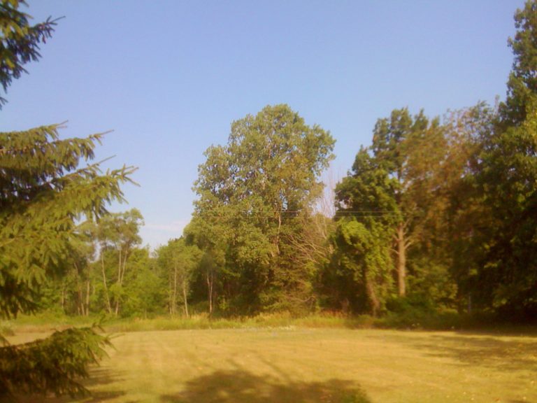
Cathie Ursu wrote a new post on the site Mid Michigan Weather 7 years, 10 months ago
There has been no rain here since June 28 and we see no chance of rain until next Monday. We were hoping for our lawn to dry up a bit, but this is getting excessive. I love the sunshine and warm temps and my t […]

-
William Brantley wrote a new post on the site Jackson, TN's Climate Summary 7 years, 10 months ago
Lowest Barometric Pressure : 30.17″ at 6 – 9 p.m.
Highest Barometric Pressure : 30.26″ at 9 a.m.Lowest Relative Humidity : 59% at 2 p.m.
Highest Relative Humidity : 100% at 5, 6 a.m.Lowest Dew Point Temp […]
-

Mark Ingalls wrote a new post on the site Ingalls Weather 7 years, 10 months ago
Ingalls Weather, along with this site’s associated Facebook page Tri-Cities Weather, has partnered with the National Oceanic and Atmospheric Administration through their Weather-Ready Nation Ambassador™ program. W […]

-
Cathie Ursu wrote a new post on the site Mid Michigan Weather 7 years, 10 months ago
Our last rainfall was on June 28 when we received a little over half an inch of rain. Since then, not a drop. These extreme hot temperatures really exacerbate the dry conditions. Today is again expected to re […]
-
Kevin Shaw posted an update 7 years, 10 months ago
@flora99 Welcome aboard. I noticed that you just signed up for Weather Together – look forward to your reports from wherever you live. Hope you can compile your profile and get it to Charlie so you can start blogging on your own WT page. Would like to know your first name (at least) sometime. I only found that you posted a public message 10 hours…[Read more]
-
Kevin Shaw wrote a new post on the site West Rockville MD Weather 7 years, 10 months ago
Sunday was another close to a perfect summer day, though slightly warmer in the afternoon. Once again, not “fall-like” as some have described it but rather like summer weather should be around here as a steady […]

-

Charlie Phillips wrote a new post on the site Charlie's Weather 7 years, 10 months ago
Sorry for such a hiatus on blogs pertaining to Pacific Northwest weather! I had a backlog of storm chasing blogs to finish up, but now that they have all finally been posted, it’s time to get back to talking about […]

-
Thank you, you too!!!
-
-
William Brantley wrote a new post on the site Jackson, TN's Climate Summary 7 years, 10 months ago
Here is Sunday – July 8, 2018`s – Historical Climate Summary !
Lowest Barometric Pressure : 30.12″ at 3 a.m.
Highest Barometric Pressure : 30.22″ at 12 p.m.Lowest Relative Humidity : 70% at 4 p.m […]
-

Jeff Taylor wrote a new post on the site Happy Valley, Oregon Weather 7 years, 10 months ago
TEMPERATURES
It was a fight between warm and cool air throughout the month, with maximum temperatures ranging from the mid-50s to the low 90s, a difference of 36.5°. The largest day-to-day difference was from […]

-
Great report Jeff. Thanks for your timely post. Beautiful wispy cirrus clouds for your monthly feature photo. We have cirrus clouds here too but rarely do they ever come out looking like those classic images. I only just started inputting my daily data into my excel spreadsheet last night. I finally got it back from Lowell in VA, who had been on vacation . Also there was a miscommunication of emails, I didn’t get his when he first sent the file back on June 22, the date of your cirrus clouds picture. Hope your fire danger is held to a min, southern OR and Northern CA have been hit hard the past few weeks. I heard that sections of I-5 were closed due to the fires. Stay cool, dry and safe!
-
-
Charlie Phillips wrote a new post on the site Charlie's Weather 7 years, 10 months ago
Here are the last 5 days of our storm chasing trip from early June. I apologize profusely for not getting these out in a timely fashion!
Day 6 (Saturday 6/2/2018)
With no storms in the vicinity for the next […]

-
Sounds like you guys are having a great time. Wish I was there although I don’t know how I would handle actually seeing a tornado. Our weather here in Michigan is pretty tame most of the time. I love your pictures.
-
-
Kevin Shaw wrote a new post on the site West Rockville MD Weather 7 years, 10 months ago
Saturday was close to a perfect summer day. Not “fall-like” but rather like summer weather should be. The muggies finally left overnight into Saturday. We had some high clouds to the SE sky in the early AM from […]

-
Harry Hayfield wrote a new post on the site The Weather of Wales (and other parts of the United Kingdom) 7 years, 10 months ago
Average daytime high: 73°F
July average daytime high: 67°F
Average night time low: 64°F
July average night time low: 53°F
Total rainfall: 0.002 inches
July average rainfall (per week): 0.625 inc […]
-
Thanks for your great weekly report Harry. Gosh the term “heatwave” is really “relative” – an average weekly high of 73 in early July would be a “cool-wave” or described as “fall-like” in my area. In areas like Death Valley is always hot, and they would need an average weekly high of 120° or above to be in a “heatwave” in that special part of the world.
How did you read 0.002″ of rainfall. In looking at your gauge, I believe the scale along the side is in hundredths, not thousandths – and normal reporting units are to the nearest hundredth. When you get into amounts less than 0.01″ if you can tell that the amount is at or over half the distance from the bottom to the 0.01″ line than that would be reported as 0.01″. If under half, it would be reported as a trace.
Now complicating things are if your rain gauge is incremented in millimeters and you are converting to inches, that is a different story. We can go into that if that is the case.
The precision of all our instruments is expressed in the paperwork for the instrument among the whole package. Carrying extra decimal places gives others a false sense of accuracy, over and above the accuracy of the instrument. For averages, tenths of a degree is the limit for reporting temperatures (I notice you gave temps in whole degrees, which is still fine if you stay consistent with that), hundredths of an inch for rainfall (rounding 5’s up normally), and at most tenths of a MPH or KM/HOUR for average wind speeds.
For daily reports, remember to try to report the temperature at observation time, and the sky condition at that time also. I look forward to seeing more of your daily reports in the coming days.
Thanks again for posting your most interesting climate statistics for your piece of the world. Cheerio, Kevin -
The measurement of the rain (which fell on July 2nd by the way) was estimated as being 0.05mm (based on the mm scale) which starts off at one mm and was then converted into inches (for the simple reason as the only non American here, common courtesy says “Adopt what everyone else is doing” so therefore although all measurements are in °C, mm and mph, they are converted into °F, inches and mph for the convivence of readers.
-
Hi Harry! Are you sure you estimated 0.05 mm. It is very tough to conceptualize that you could estimate that small an amount. I could believe 0.5 mm, but 0.05 mm is a bit too small to get any sort of estimate, IMHO. In the US, if you actually can read in thousandths of a second, or hundredths of a mm, amounts of 0.004″ or 0.05 mm or less would be expressed as a trace amount. Above those values but still less than 0.01″ or 0.1 mm would be rounded up to 0.01″ or 0.1 mm. I have a query into one of our cocorahs headquarters precipitation experts about this question and will relay his findings here. cocorahs is a nationwide precipitation reporting database, piped into many researchers and our NWS to get a pulse on the daily rainfall (and snowfall and snow depth in the winter) amounts. If you can get your internet to hook up with https://www.cocorahs.org you can view/read/download the extensive data included. I have contributed my daily rainfall every day since October 2005, with some glitches in the record around the time I moved at the end of 2016 and beginning of 2017. Thanks, have a great day. Cheerio, Kevin
-
-
William Brantley wrote a new post on the site Jackson, TN's Climate Summary 7 years, 10 months ago
Here is Saturday – July 7, 2018`s – Historical Climate Summary !
Lowest Barometric Pressure : 30.08″ at 6 p.m.
Highest Barometric Pressure : 30.18″ at 11 a.m., 12 p.m.Lowest Relative Humidity : 70% at 3, […]
-
Cathie Ursu wrote a new post on the site Mid Michigan Weather 7 years, 10 months ago
This area hasn’t had a good rain in over a week now, and with the excessive heat, we are badly in need of rain. But with this wonderful weather, it’s really hard to complain. Yesterday was a perfect weather d […]

-
Kevin Shaw wrote a new post on the site West Rockville MD Weather 7 years, 10 months ago
The “heat wave” broke today after 7 days with max temps of 90° or more but it was still muggy as the “cold” front took a while to get through the area. We “only” topped out at a 84.7° high, helped out by a lot o […]

- Load More