-
Josh Henderson wrote a new post on the site Sola Virtus Observatory Wx Report 8 years, 1 month ago
Weather Summary for Sunday 03.25.18: Variable Cloudiness and Breezy with Snow Showers and a Snow Squall in the early afternoon. Becoming Mostly Sunny. The High Temperature reached 43.1 °F at 4:52 pm. Humidi […]

-
William Brantley wrote a new post on the site Jackson, TN's Climate Summary 8 years, 1 month ago
Lowest Barometric Pressure : 29.91″ at 12 a.m.
Highest Barometric Pressure : 30.13″ at 10 p.m.Lowest Relative Humidity : 74% at 2, 3 p.m.
Highest Relative Humidity : 100% at 5 a.m.Lowest Dew Point Tem […]

-

Cathie Ursu wrote a new post on the site Mid Michigan Weather 8 years, 1 month ago
Looking out my window, I see a beautiful day with plenty of sun. Unfortunately, we continue to have a strong wind blowing from the east and it is cold! Things are supposed to improve next week with hig […]
-

Kevin Shaw wrote a new post on the site West Rockville MD Weather 8 years, 1 month ago
Saturday was partly cloudy, a tad milder PM but still freezing in the early AM (through 3/25 21 of 25 days have had freezing mins this March), with the snowpack melted off to 0 from the strong March sun. Today’s […]

-
joe maggio became a registered member 8 years, 1 month ago
-
William Brantley wrote a new post on the site Jackson, TN's Climate Summary 8 years, 1 month ago
Lowest Barometric Pressure : 29.77″ at 7 p.m.
Highest Barometric Pressure : 30.02″ at 12 a.m.Lowest Relative Humidity : 52% at 3 a.m.
Highest Relative Humidity : 97% at 3 p.m.Lowest Dew Point Tem […]
-

Charlie Phillips wrote a new post on the site Charlie's Weather 8 years, 1 month ago
I’m back! My sincere apologies for being AWOL the last month. I have, however, been working hard on WeatherTogether’s weather models, though I’m having some connectivity issues uploading them to the site since […]

-

Glad to see you back online. I may have to call in sick on Monday!
-
-
Kevin Shaw wrote a new post on the site West Rockville MD Weather 8 years, 1 month ago
Friday was mostly sunny, a tad milder PM but still freezing in the early AM (through 3/24 20 of 24 days have had freezing mins this March), with the snowpack just about wiped out from the strong March sun. […]

-
Cathie Ursu wrote a new post on the site Mid Michigan Weather 8 years, 1 month ago
This has been a very dry month for us and burn bans have now been issued. We haven’t had any rain since the first week of March, and none is expected until possibly Tuesday. I’m in the mood for a good t […]

-
Josh Henderson wrote a new post on the site Sola Virtus Observatory Wx Report 8 years, 1 month ago
Weather Summary for Friday 03.23.18: Sunny and Breezy.The High Temperature reached 41.7 °F at 4:49 pm. Humidity High: 71%…. Humidity Low: 45%…..Dew Pt. High: 23.9°F… Dew Pt. Low: 18.8 °F.. […]
-
I’m glad that you’re back, Josh. Missed your posts.
-
-
William Brantley wrote a new post on the site Jackson, TN's Climate Summary 8 years, 1 month ago
Lowest Barometric Pressure : 30.02″ at 11:59 p.m.
Highest Barometric Pressure : 30.30″ at 12, 2 a.m.Lowest Relative Humidity : 40% at 1, 2 p.m.
Highest Relative Humidity : 93% at 12 a.m.Lowest Dew Poi […]
-
Cathie Ursu wrote a new post on the site Mid Michigan Weather 8 years, 1 month ago
It seems a bit strange to have such an extended period of dry weather at this time of the year here in Michigan. This is usually our rainy/stormy time of year. There isn’t any rain in the forecast until n […]

-
Kevin Shaw wrote a new post on the site West Rockville MD Weather 8 years, 1 month ago
Thursday became mostly sunny mid-day but with high clouds, and middle-to high cloud overcast by evening, milder than yesterday with unfortunately a good part of our newly acquired snowpack melting away from the […]

-
William Brantley wrote a new post on the site Jackson, TN's Climate Summary 8 years, 1 month ago
Lowest Barometric Pressure : 30.26″ at 12 a.m.
Highest Barometric Pressure : 30.40″ at 10, 11 a.m.Lowest Relative Humidity : 36% at 4, 5 p.m.
Highest Relative Humidity : 100% at 5, 6 a.m.Lowest Dew Poi […]
-
Josh Henderson wrote a new post on the site Sola Virtus Observatory Wx Report 8 years, 1 month ago
Weather Summary for Wednesday 03.21.18: A 2 part Winter Storm moved in with the first low arriving Tuesday and the second low arriving Wednesday morning and ending early morning Thursday. Mainly a Snow eve […]
-
So good to see your report here once again Josh. You sure had a lot more snow than I did! I had a lot more mist and sleet than you did. We all be equal again by the end of the weekend, as the warm March sun will bring us both down to no snow on the ground by the end of Sunday, if not before. In Eastern/Central MD the highest 2-day snowfall total was 16..7″ at Thurmont 3N out of cocorahs. Looks like the observer there works for NWS in Silver Spring. He is at 1144″ elevation. I believe he is also the station that Washington DC Channel 4 reports for temperatures on occasion – he does appear to be several degrees colder than other stations in the immediate area. Keep up the great reports here – they are very much appreciated. Cheers, Kevin
-

Welcome back Josh! Great to read your posts again!
-
-
Kevin Shaw wrote a new post on the site West Rockville MD Weather 8 years, 1 month ago
Wednesday, the first full day of spring, featured unspring-like weather with cloudy skies, even colder temperatures, and sleet and mostly snow most of the day (0.32″) that adversely affected many in the area, with […]

-
Cathie Ursu wrote a new post on the site Mid Michigan Weather 8 years, 1 month ago
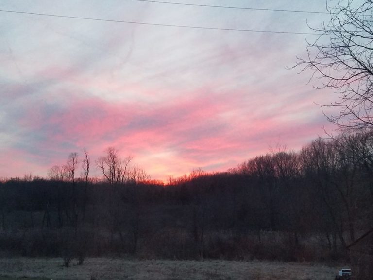
This morning is very chilly with temps in the teens. We did have a lovely sunrise which compensates a bit, but it would certainly be nice for warmer weather to arrive. Our snow is gone except for shady a […]

-
William Brantley wrote a new post on the site Jackson, TN's Climate Summary 8 years, 1 month ago
Lowest Barometric Pressure : 29.93″ at 12 a.m.
Highest Barometric Pressure : 30.26″ at 11:59 p.m.Lowest Relative Humidity : 50% at 5 p.m.
Highest Relative Humidity : 92% at 2 a.m., 11, 11:59 p.m […] -
Cathie Ursu wrote a new post on the site Mid Michigan Weather 8 years, 2 months ago
After all the snow that we have had, it seems strange to have clear, dry weather for so many days in a row. Now the forecast is saying no precip until next Tuesday. We still have small patches of snow w […]

-
Kevin Shaw wrote a new post on the site West Rockville MD Weather 8 years, 2 months ago
Tuesday featured cloudy skies, much colder temperatures, and precipitation most of the day (0.69″) of first rain, then sleet, then snow, mostly light (snow/sleet/ice total 0.8″). Temperatures started out in the […]

- Load More

Hi Josh! The Observatory Cam picture in this post is interesting. When was that shot? This morning? Or a few days ago? I was just wondering if you really had that much snow on the ground this morning…. I could not find snow on ground reported anywhere in this report. I know I can look for it in your cocorahs report and I will do that later. Good to hear from you, keep us posted as much as you physically can. Enjoy it!
it updates every couple of minutes even on the blog post, so it will be the latest image whenever you check the post or refresh the page. I have about .07″ on the ground yet out of the 13.1″. Those grassy areas are where i cleared it with the tractor.