-
William Brantley wrote a new post on the site Jackson, TN's Climate Summary 8 years, 9 months ago
Here is Tuesday – November 21, 2017`s – Historical Climate Summary !
Lowest Barometric Pressure : 30.00″ at 3 p.m.
Highest Barometric Pressure : 30.17″ at 11:59 p.m.Lowest Relative Humidity : 39% at 2 p.m […]

-

Jeff Taylor wrote a new post on the site Maryland Climate and Weather 8 years, 9 months ago
Baltimore and Washington: Extreme Precipitation Within Their Political Boundaries
 Most larger U.S. cities have one “official” National Weather Service (NWS) weather station for which climate data is recorded […]
-

Thanks for this great collection of data Jeff. It looks really good and complete at my first glance. I will be studying it further as the days go by, and noting any comments about it to you.
Kevin -
I also look forward to your analysis and data for the temperatures of these same stations coming soon. Thanks for all your efforts, Kevin
-
Thanks for the reply, Kevin. It’s certainly been a labor of love working on this historical data for the last 15 or so years. As I continue to format new things to post for Maryland, I would like to start working more fully on the State of Oregon’s historical data.
-

Awesome post Jeff! I thought local climatological differences in Seattle were huge, but I think they are even bigger in Portland due to the Columbia River Gorge. I’m in Northeast PDX, so we are windier and cooler during gorge outflow events, and our freezing rain lasts far later than downtown.
One thing that would be really interesting is finding the rate at which local differences in weather stations change over the climatological record. I assume it would be greatest in periods of concentrated urbanization around the applicable weather stations.
Thanks for all your hard work, and I look forward to your temperature findings and eventually your Oregon data!
-
Thanks, Charlie! It’s been interesting learning and observing the local climatological differences here in the Portland area. The Gorge certainly has a huge influence with those strong easterly winds bringing inland colder winter air and warmer summer air. Here in Happy Valley we’re somewhat protected compared to you as the hills tend to block the strongest winds and sinking cold air. Of course, the coastal waters certainly have an impact as well from the other direction.
Another thing I’m interested in finding out is why the Portland Airport (PDX), right on the Columbia River, experiences less precipitation, on average, than other parts of the Metro area (10% or more), even compared to the long-term downtown weather station(s). Local Annual Means for the 1981-2010 period are thus:
PDX: 36.03″
Downtown (KGW-TV): 42.85″
Portland WFO: 43.47″
Hillsboro AP: 39.90″
Oregon City: 44.21″
Troutdale: 46.97″
Beaverton (Nature Park): 40.06″
Vancouver AP: 39.14″
Happy Valley: (no COOP station here but I continually record more, on average)
Is there a valid difference or is there an issue with siting or instrumentation at PDX?One other thing that interests me here is why we get so much small hail! Prior to moving here, I had never heard or even thought that the Willamette would get much hail at all. In the 3 1/2 years that I’ve been observing here, I have actually observed 25 hail days and 37 separate events (4 events in 1 day and 3 events two other days). I know atmospheric lift is required and I’m assuming the coast, coastal mountains and the Cascades are a major player but I’d like to hear/see an expert explanation from a meteorologist such as yourself!
-
Great work Jeff. I’m almost sure you spent countless hours building these tables. The color looks great.
-
Thanks for the feedback, Marty!
-
-
-

Cathie Ursu wrote a new post on the site Mid Michigan Weather 8 years, 9 months ago
There is a slight chance for a shower or two today, but it will be far from a washout. At least we have a little sun this morning. Yesterday was quite nice and there was a lot of sunshine, but strong wi […]

-
Josh Henderson wrote a new post on the site Sola Virtus Observatory Wx Report 8 years, 9 months ago
Weather Summary for Monday 11.20.17: A Sunny day a few passing Clouds. Windy conditions diminishing in the late afternoon. The High Temperature reached 46.1°F at 3:26 pm. Humidity High: 68%…. Humi […]

-
It looks like your trees are holding onto their leaves also. I can’t believe how many this late in the season, even with the winds that we have had.
-
Cathie, They are to my dismay….need to get this mess cleaned up. I still have a lot of shrubs with leaves still on them….
-
-
-
Kevin Shaw wrote a new post on the site West Rockville MD Weather 8 years, 9 months ago
Monday was partly cloudy, colder, breezy at times and dry. Temperatures started in the mid 30s in the early AM, and rose some during the day to the upper 40s in the mid-afternoon. Dew points held in the 20s all […]

-
William Brantley wrote a new post on the site Jackson, TN's Climate Summary 8 years, 9 months ago
Here is Monday – November 20, 2017`s – Historical Climate Summary !
Lowest Barometric Pressure : 30.05″ at 11:59 p.m.
Highest Barometric Pressure : 30.28″ at 8, 9 a.m.Lowest Relative Humidity : 26% at 2 p […]
-

Mark Ingalls wrote a new post on the site Ingalls Weather 8 years, 9 months ago
An atmospheric river is set up to douse almost the entire West Coast. Raising freezing levels today and tomorrow will aid Thanksgiving travelers the next couple of days, keeping snow off of the major passes. By […]

-
Cathie Ursu wrote a new post on the site Mid Michigan Weather 8 years, 9 months ago
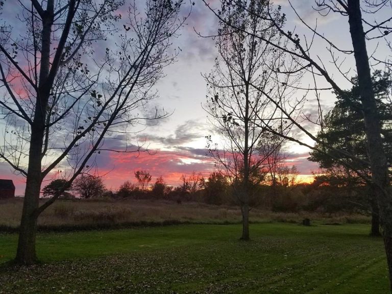
This morning is quite breezy, the sun is shining and temperatures should be warmer than yesterday. The scattered snow showers that we had yesterday left no trace today, and most of the upcoming week should […]
-
Josh Henderson wrote a new post on the site Sola Virtus Observatory Wx Report 8 years, 9 months ago
Weather Summary for Sunday 11.19.17: A mix of Clouds and Sun with Windy conditions. The High Temperature reached 49.4°F at 11:12 am. Humidity High: 93%…. Humidity Low: 52%…..Dew Pt. High: 53°F. […]

-
Kevin Shaw wrote a new post on the site West Rockville MD Weather 8 years, 9 months ago
The start of Sunday was cloudy, mild and wet (0.16″) overnight then clearing, windy, and gradually cooler in the later AM and PM hours as a cold front swept through the area. Temperatures started in the upper 50s […]

-

Karl Bonner wrote a new post on the site Karl's Weather Discussions 8 years, 9 months ago
It begins on December 20/21 and ends March 19/20, if you follow the conventional calendar.
It begins on November 6/7 and ends February 3/4, if you go strictly by sun angle.
It begins on December 1 and ends […]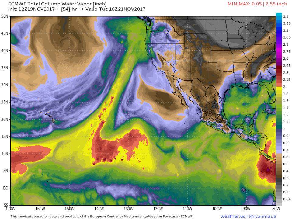
-
Karl Bonner wrote a new post on the site Karl Bonner's Weather Blog 8 years, 9 months ago
It begins on December 20/21 and ends March 19/20, if you follow the conventional calendar.
It begins on November 6/7 and ends February 3/4, if you go strictly by sun angle.
It begins on December 1 and ends […]
-
Great post Karl. I especially liked your reasoning for the “real” winter for the Pacific Northwest.
I’ve always wondered what November 1955 was like… I remember from when I was a kid seeing super low record lows on the KOMO newscasts during mid November and being in disbelief. Here’s the temps at Sea-Tac from that stretch of November 1955.
11/11: 38/15
11/12: 21/13
11/13: 23/14
11/14: 23/9
11/15: 24/6
11/16: 31/21
11/17: 31/23The reanalysis data from NCEP has the textbook arctic outbreak pattern for the PNW – I’m still trying to figure out why this air mass was so cold though. Sea-Tac got 1.4 inches of snow on the 11th and didn’t get any more until 4.6 inches from an overrunning event on the 17th. The lack of snow makes this event all the more impressive.
500mb reanalysis plot: https://cdn.weathertogether.net/wp-content/uploads/sites/5/2017/11/USA_500mb_Nov1955.gif
-
1955 was off the f**** scale. That’s really the only term that does it justice.
-
-
William Brantley wrote a new post on the site Jackson, TN's Climate Summary 8 years, 9 months ago
Here is Sunday – November 19, 2017`s – Historical Climate Summary !
Lowest Barometric Pressure : 30.07″ at 12 a.m.
Highest Barometric Pressure : 30.27″ at 11, 11:59 p.m.Lowest Relative Humidity : 44% at […]
-
Cathie Ursu wrote a new post on the site Mid Michigan Weather 8 years, 9 months ago
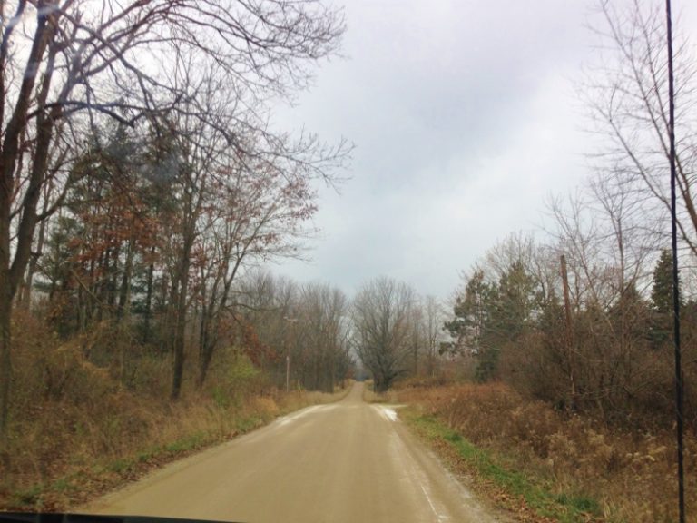
We had rain most of our Sunday which turned into snow in the early evening. The ground began to cover but it didn’t last long. The ground is still too warm for any snow to last. We have snow flurries th […]
-
Kevin Shaw wrote a new post on the site West Rockville MD Weather 8 years, 9 months ago
Saturday was a cloudy, warmer, breezy day that finally got a bit of rain right at the very end of the observation day (0.02″). Temperatures started in the mid 30s then warmed up all day after a warm front passed […]

-
Josh Henderson wrote a new post on the site Sola Virtus Observatory Wx Report 8 years, 9 months ago
Weather Summary for Saturday 11.18.17: Partly Cloudy before 9 am then Clouds with intervals of Showers starting at 10:38 am. The High Temperature reached 57.2°F at 11:53 pm. Humidity High: 93%…. Humi […]
-
William Brantley wrote a new post on the site Jackson, TN's Climate Summary 8 years, 9 months ago
Here is Saturday – November 18, 2017`s – Historical Climate Summary !
Lowest Barometric Pressure : 29.48″ at 2 p.m.
Highest Barometric Pressure : 30.07″ at 11:59 p.m.Lowest Relative Humidity : 69% at 6 p […]
-
Cathie Ursu wrote a new post on the site Mid Michigan Weather 8 years, 9 months ago
Heavy rain moved into our area late last night dumping 0.63 inches in my area. Some areas received over an inch. There is another round coming later today, and with falling temps, it could change to snow e […]

-
Kevin Shaw wrote a new post on the site West Rockville MD Weather 8 years, 9 months ago
Friday was a cooler, partly cloudy, breezy at times day to finish up the workweek. I checked data reported yesterday and all checked out correctly except for minor timing differences not worth reporting further […]

-
Josh Henderson wrote a new post on the site Sola Virtus Observatory Wx Report 8 years, 9 months ago
Weather Summary for Friday 11.17.17: Sun and some fair weather Clouds. The High Temperature reached 48.8°F at 2:54 pm. Humidity High: 81%…. Humidity Low: 42%…..Dew Pt. High: 30.1°F…..Dew Pt. Low: […]
- Load More